There was nothing morbid about it. I wanted to visit the site of a plane that had crashed 40 years ago in the wilderness, where the wreckage still remained. One of the main reasons this interested me: it was going to be a very challenging hike physically, also one where I would have to plot the course myself since there are no trails to the site.
Well actually, the route started at a very popular trailhead, and the first couple of miles were spent passing people and their dogs on the trail. I wasn’t in the mood for people. I couldn’t wait to take the detour that would take me off the trail, up steep mountain sides, past beautiful unnamed lakes, and over snowfields where very few people tread.
As I sat resting on a boulder next to this lake, I thought to myself, if this is all the further I go, the hike will have been worth it. It was serene.
I continued on up the mountainside for probably another hour, having doubts that I would have the energy to make it. After crossing several slippery snowfields and climbing some scree fields, I paused by a small pond and looked up the mountainside at the route ahead and decided to stop. My GPS told me the plane crash was still 3/4 of a mile up. I decided to stop and not go further. I snacked and rested. I pulled out my digital thermometer and it read 66.6 degrees. I wondered if anyone had died in the plane crash.
I finally pulled out the map and realized that I had already climbed 95% of the distance in terms of elevation, that if I continued another 100 yards, the remainder of the hike would be mostly level next to a lake. I plotted a course over the remaing boulder and snow fields.
I finally reached the top of the “shelf”. Now it was a level half-mile walk to the crash site.
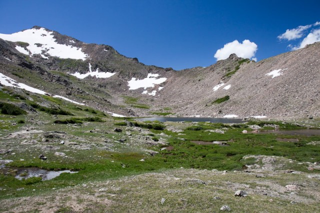
A view of the Continental Divide. The plane had crashed trying to get over this. The wreckage is between the snowfield in the center of the photo and the edge of the lake. (The wreckage is too small to be seen in this photo.)
Steven had told me about this wreck years ago and I added to a list of hikes I’d like to do one day. I had forgotten all of the details like what type of plane was it, had anyone died in the crash, etc. The only thing I did remember, it crashed in 1971.
Since returning home, I’ve researched the plane which now gives me some perspective into the photos I took. The plane was an AT-6G used by the Air Force and the Navy to train pilots in World War II. It was a stout plane containing two seats, one behind the other. Here is a photo of what it looks like from Wikipedia:
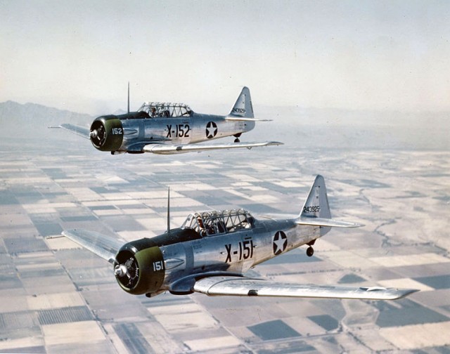
Two U.S. Army Air Forces North American AT-6C-NT Texan trainers in flight near Luke Field, Arizona (USA), in 1943.
The plane was owned by a civilian pilot who had repainted it. He was a 29 year old flight instructor with 4200 hours of flying experience, and 99 hours flying time in this particular plane. He was flying from Denver to Steamboat Springs, Colorado. The NTSB attributes the crash to pilot error and he did die in the crash. Many planes have crashed along this section of the Continental Divide during the winter when there are strong downdrafts created by the wind blowing across the divide.
The hike to the crash site was one of the most challenging and most satisfying I’ve ever done. I had great weather as well.

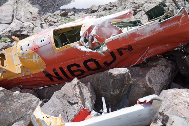
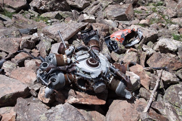

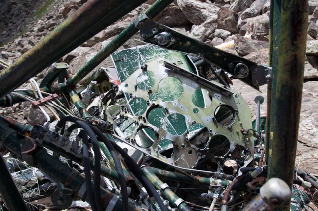
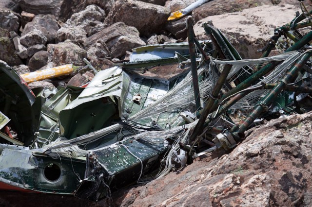
That’s neat. At first, I got the impression this was the plan crash you told us about when we were doing Rollins’ Pass. Maybe someday we can all do this one.
There are about a half dozen plane wrecks in the area. The more recent ones have been removed and you have to look for small debris like broken bits of plastic or glass. I don’t remember which plane crash I mentioned to because there are two in that area.
Hello, My name is Suzy. A couple of days ago my grandson was doing a family tree for a school project, and he came across your information about his grandfather, my first husband. You can imagine my surprise at seeing this after all these years. The pilot was not only a flight instructor, but also a United Airlines first officer and his name was Myke Baar. He always used this route to cross the mountains, which he referred to as Jones Pass, because he could usually slip right over in any kind of weather. We lived in Steamboat Springs at the time, and I still do. I was doubly surprised to see this because a salvage company contacted me 44 years ago and asked me if they could have the wreckage. Of course I said yes and I assumed that there was no longer any physical evidence of the accident on the mountainside. My three children are very interested in viewing the site of where their father went down, and I am wondering if you could give me a GPS route so that we could make the hike? I am also wondering if horses could make it part of the way, maybe to the lake right below the crash site? When I read that you had a hard time and were thinking of not completing the trek, I am not sure that I can make it up there at 72 years old! I hope that you get this response and that you will email me this information. Obviously, this site took brought me back to some very sad memories, but, at the same time, I would like to be able to help all of my children, their spouses and children, and myself and my husband to be able to visit this sacred ground if they want to. Thank you
Hi Suzy,
Thanks for commenting on this. The year I did this hike was 2011. I’ll try to dig up the GPS info and send it to you within the next day or two.
Thank you for this Randy. My brother Myke was an amazing man.
I will learn more about him next week. I hope you will be joining us.
that was my grandpa who was in the plane
I hope you will be able to take the hike with us. If not this time, maybe in the future.