From the Continental Divide
I sat on the jagged granite of the Continental Divide, up at 12,000 feet elevation, contemplating water. The water in front of me, if left to it’s own devices, would end up in the Pacific Ocean. The water in the lakes behind me would end up in the Atlantic Ocean. If the water were to meet, it would be at the tip of South America. I was struck by the thought that if I poured out the water in my bottle, it would be split to take long separate journeys, probably never to be joined again.
Actually the water from here probably will never make it to either ocean. It will be consumed for human use either directly or as irrigation, or both. Then it will probably evaporate and end up in the atmosphere. But this morning, sitting on the divide, my focus was on the long journeys in the oceans.
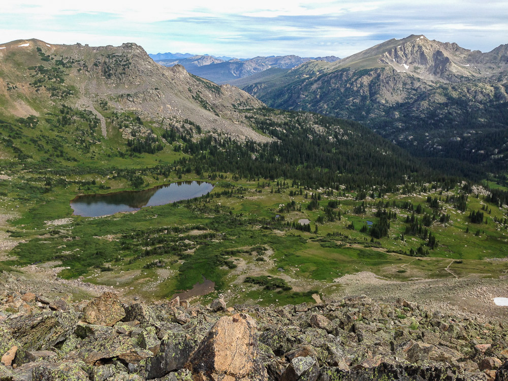
I hiked down through the wilderness in an area I’ve never been before. I discovered the old wreck of yet another aircraft.
Aircraft wing
I wasn’t surprised by it. Lux had once told me there were two old wrecks in this part of the wilderness. I had forgotten about it. I visited the other wreck 4 years ago in 2011. There wasn’t much left of this one. The fuselage and engine had definitely been removed from the area. The only thing left were parts of the wings and part of the tail. If some entity went through the trouble of air-lifting the remains out of this wilderness, then why leave the wings behind?
These days, all of the wreckage is removed from the wilderness if a plane crashes. Anything that had crashed prior to the 1980’s was left behind. A lot of planes have crashed here due to the tall mountains and the strong downdrafts on the east side of the Divide that occur in winter. In every case, it was ultimately pilot error.
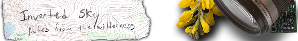
For the next 3 hours I continued down the valley, mostly trying to find a suitable route. The valley is full of small lakes, ponds, marshes and granite cliffs. As I mentioned, I have never hiked in this valley before and I wasn’t entirely sure there was a passable route down. The trail I had hiked up runs up beside the valley and the backup plan was to take that down if I couldn’t find a way.
After having to double back up the valley a few times due to a long cliff I couldn’t get down, I finally found some soft soil with a bunch of deer and elk footprints imprinted in it, which hinted at the route to take. Once I was down through the steepest area, I stopped beside the creek and put my hand in it.
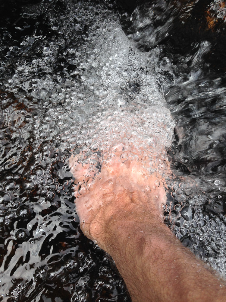
The ice cold effervescent water was as clear as glass. Although it’s much further downstream, this is the same creek that supplies my town with it’s water. And knowing the source of this water is up in the wilderness, makes me happy.


