It was my turn to host the monthly adventure that I share with Rob and Sherrie. In the past we’ve spent many hours exploring the fading history of Colorado, whether it be old mining sites or steam driven trains and what remains of their routes. This month I decided to focus on a train route that was created around 1903 and most of which is still in use today.
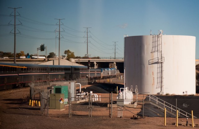
We started with homemade breakfast burritos on a cliff overlooking the present day tracks near Pinecliffe, Colorado. The original plan was to watch Amtrak’s California Zephyr pass below us on it’s way to California. The Zephyr is rarely on time and that day was no exception. Armed with my scanner radio, we found there were a couple of freight trains approaching.
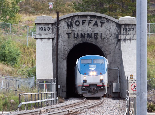
We heard the eastbound coal train approaching the Pinecliffe siding which was just out of our view. A few minutes later the westbound freight train approached from the opposite direction, from Denver. The winding route from Denver passes through nearly 30 tunnels before reaching the 6.2 mile long Moffat Tunnel, which passes under the Continental Divide. It was originally constructed as a narrow gauge railroad and later converted to standard gauge.
After the freight train passed, it was apparent the coal train was going to stay a bit longer on the Pinecliffe siding so we opted to follow the freight train westward up to the Moffat Tunnel. There it was to be held while a number of eastbound trains were to come out of the tunnel.
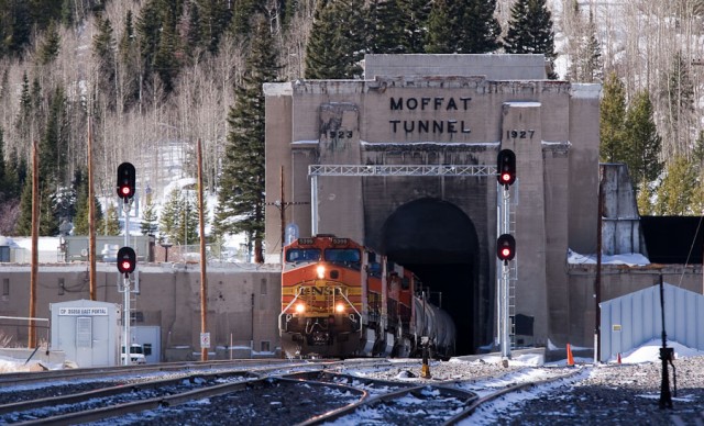
At the east portal, we watched our freight train pull up and stop on the siding while a BNSF train carrying empty corn syrup tankers emerged from the tunnel. After a train passes through the tunnel, very large blowers, the size of jet engines, turn on and suck all 6.2 miles worth of air out of the tunnel, to remove the accumulated exhaust fumes from the diesel engines.
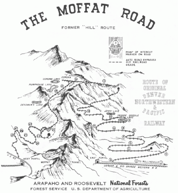
Before the tunnel was built in the mid 1920’s, the train route continued winding up and over The Divide. Today it is a 4-wheel drive road. In the map below, you can see the Moffat Tunnel near the bottom. Although it is not to scale, you can see how much shorter the route became when the Moffat Tunnel opened.

Click for a slightly larger version
We departed East Portal and headed up the rough road. In spite of the glorious weather, after 4 or 5 miles we found the road still blocked with winter’s snow. We were at least several miles from our goal near the top of the pass, the Needle’s Eye Tunnel. With no sign of afternoon thunderstorms, we decided to walk the remaining distance to the tunnel.
Back in the late 80’s, the road was open all of the way through from one side to the other. One could drive their car through the old train tunnel. Due to some falling rocks in the tunnel, it has since been closed which leaves no route across the pass. There are still some efforts to fix the tunnel and re-open it, but the U.S. Forest Service doesn’t really want that, so it’s dragging on and on. On a couple of occasions in the past, I was able to drive through the tunnel before it closed.
We reached Yankee Doodle Lake. There was water flowing everywhere in little streams as the winter snowpack melted. The flowers were blooming and the air was sweet.
Just past the lake our route was again covered with snow. A snowfield probably 10-15 feet deep in places blocked our route. Perhaps the intoxicating beauty of the day was screaming that we couldn’t just turn around. I thought that we might be able to traverse the sloping snow, but my companions, rightly so, declined.
The Needle’s Eye Tunnel was 600-700 feet straight up the mountain side above us. They suggested we try avoiding the snow and climbing the scree. So we set off up the 45 to 65 degree slope. I eventually led the way scouting up to find the best route. It was not easy with areas of loose soil and rock. At one point I began to have doubts that this was a good idea but I was already past the point of no return. The three of us made it up and heartily agreed that we were going to find a different route down. There was no way any of us wanted to go down the way we had come up.
We caught our breath and explored the tunnel entrance. Then we continued up along the gradual railroad grade, over the old trestles, over the continental divide, only to find a Jeep and some people from Kansas up there. They had come up from the Winter Park side. I was surprised the road was passable as I had guessed there would be even more snow over there.
It was starting to get late and we were a couple of hours from my vehicle. It was time to decide how we were going to get back. I offered two choices for getting back. One I had taken many times in the past and involved hiking down a ridge near Forest Lakes. The problem was that we didn’t know how much snow would have blocked that route. The other choice was a former 4-wheel drive road that involved going down, up and down again to reach Yankee Doodle Lake. We could see from our vantage point that it was relatively clear of snow. Although it was longer, we opted for the old 4-wheeled drive road.
Up on the Continental Divide we had great views of the state. We were near 11,700 feet in elevation. There were towering clouds over the Denver area. As we walked, there was a remarkable moment as if passing through an invisible door, we walked from dry light air into humid and dense air in the span of about 20 feet.
We reached the saddle in the road, which was about 400-500 feet above the lake. I really didn’t want to follow the road over a mile to get down there, so peering down I started plotting a route down the steep terrain to the lake. I convince my companions that it shouldn’t be that difficult since there were trees and other vegetation to hold on to in case we started to slide.
They probably should have ignored me. Once we were down about half way, we were thwarted by a 20 foot drop-off that wasn’t visible from the top (it’s always like that). I didn’t want to climb back up to the road, so I opted to go down through a very steep streambed beside the cliff which ended at the top of a steep snowfield. The bottom of the snowfield was near the railroad grade next to the lake. It started to rain lightly.
I’ve slid down a number of snowfields in my years of hiking. But my companions were less sure about that prospect. There was no choice. I pulled the jacket out of my pack set it on the snow, sat down on it, and I was off.
In a matter of seconds I had reached the bottom. There is really no way to steer when going down like that. I had learned how to slide down using my boots as little skis, which allows some turning ability, but with tired legs I didn’t trust that I could do it without falling on my face.
At this point I figured my companions were hating me for convincing them to take this route down. They eventually slid down the snowfield, but didn’t seem too happy about it. Rob had a pretty stressed look on his face like his life was being threatened. We all made it back to the railroad grade, the sky cleared up as we walked back to the car.
At my house and after a couple of glasses of wine and some bison burgers, we were smiling about the day’s adventures. And with each recouting of the events, the slopes got steeper and the story of a unforegttable adventure had emerged.


